


Attica
Physical Description
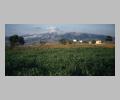
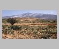
Attica is a small triangular peninsula promontory with an area of only 3350 sq. km. On the east and south the region is bordered by the Aegean Sea, and the northern border with Boeotia is formed by Mts. Parnes and Kithairon. The Megarid is on the west. The landscape of Attica is divided into three interconnecting plains by four mountain systems: Aegalos, Hymettos, Pentelicus, and Laurium. To the west lies the Thracian plain, including both the plain surrounding Athens and Eleusis, and extending southward to the plain of Zoster. To the east lies the midland district, Mesogeia, which is an undulating plain renowned for its vines.The southern tip of Attica is the promontory of Sounion, jutting into the Aegean towards the Cyclades. It is estimated that in antiquity the territory of Attica, including the island of Salamis, had a population of 500,000, of whom nearly four-fifths were slaves. The soil of Attica is not fertile, and water is scarce. The chief river of the region, today a small stream, is the Kephissos. It rises on Mount Parnes and flows through the Athenian plain. Attica has always been famous for its olives and its oil. Figs and vines are of secondary importance. The mountains surrounding the central Attic plain also had economic importance. Mount Parnes and Mount Pentelicus are sources of beautiful white marble, and Mount Hymettos, covered in thyme, was a source of honey, a celebrated delicacy. Piraeus, which faces the Saronic Gulf, has been the port of Athens and the principal port of Attica since the fifth century B.C. In addition to the main harbor, Kantharos, there are two smaller harbors on the east coast, called Zea and Munychia.History
Tradition holds that in very early times there were several kingdoms in Attica and in the thirteenth century B.C., an Athenian state was formed by an act of union. Some such union enabled Attica to make an early recovery in the early Iron Age from the collapse of the Mycenaean civilization. The Ionian dialect was spoken in Attica, and western Turkey was called Ionia in antiquity because tradition held that the Greeks in Asia Minor were immigrants from Attica.Sites
Athens, the political center of Attica since its unification (attributed to Theseus), is located in the middle of a wide coastal plain with easy access to a harbour at Piraeus. It also provided its early inhabitants with great security. The plain is surrounded by a number of low hills, among them Lykabettos ( 277 m), and Anchesmos ( 338 m), both of which lay outside the city walls in antiquity. The third and most important hill to the city, is the Acropolis (156 m). To the south of the Acropolis are other historically important hills: the Hill of the Nymphs ( 105 m), the Pnyx ( 110 m), the meeting place of the ekklesia, and the Hill of the Muses ( 147 m). Ancient Athens was ill provided with water, but was traversed by two streams the Eridanos, which rises on Lykabettos leaving the city precincts near the Sacred Gate in the Kerameikos, and flowing west to join the Ilissos. The Ilissos rises on the southwest slopes of Hymettos and flows westward to join the Kephissos. To the north of the Acropolis lay a number of large open squares, the agora, the Roman Market, and the Library of Hadrian, the last two being later additions to the Classical city. The Athenian Agora was conveniently situated between the Acropolis and the Dipylon, principal gateway of the city. The area east of the Acropolis is dominated by the Olympeion, the temple of Olympian Zeus, supreme god of the Greek Pantheon. The huge temple was begun by Hippias in c. 550 B.C. and completed by Hadrian in c. 130 A.D. It is the largest temple in Greece. Gracing the exterior of the temple are 8 by 20 Corinthian columns of Pentelic marble, each of which is 17 m high. To the west of the Olympeion precinct stands the Arch of Hadrian, which marks the boundary between the ancient city of Athens (city of Theseus) and the Roman additions to the city (city of Hadrian). Amphiaraion, a sanctuary and home of an oracle, is situated in a quiet, wooded area in northern Attica opposite Euboea near Oropos. The temple, dedicated to Amphiaraos, was erected in the fourth or third century B.C., and has 6 Doric columns along its front between pilasters. The interior is divided into 3 aisles by 2 rows of 5 columns. In front of the temple is an altar. The site also includes and incubation hall for worshippers seeking a cure and a theater built in the fourth century B.C. Rhamnous is found on the north coast, east of Amphiaraion. Rhamnous was a coastal stronghold for Attica, and the site of the Sanctuary of Themis and Nemesis, the goddesses of the Righteousness and of Retribution. There is a polygonal limestone temple in antis built in c. 500 B.C., which is dedicated to Themis, adjoining it is the larger Doric peripteral temple of Nemesis dated to c. 430 B.C., and it is famous for its numerous inscriptions. In the center of Attica is Dekeleia, a fortress guarding the easternmost of the three passes over Mount Parnes, a vital route for bringing food from Euboea to Athens. This site was captured by the Spartans in the Peloponnesian War, which contributed to the defeat of Athens. Opposite Dekeleia on the western slopes of Parnes sits Phyle. Located on an inland plateau in the Attic countryside, Phyle commands the road from Athens to Tanagra in Boeotia. Although a fortress was built on this site in the fifth century B.C. to protect the frontiers of Attica, very little of it remains. In its place stands a fourteenth century A.D. monastery. South of Phyle on the route to Athens is Acharnai, a town surrounded by vineyards and famous in literary terms as the setting of Aristophanes' Acharnians. The site was occupied from Mycenaean times, and in classical times its inhabitants engaged in charcoal burning on Mount Parnes. In westernmost Attica lies the fortress of Eleutherai. Originally Eleutherai was Boeotian, but it was acquired by Athens in the sixth century B.C. In the fourth century B.C. excellent defensive walls were erected which were 3.6 m high with several rectangular towers along the circuit, and the walls today are among the best preserved and most interesting of ancient fortifications. Eleusis is a city located southwest of Akharnai and 22 km west of central Athens. Eleusis is an important sanctuary of Demeter and home of the Eleusian mysteries, possible the most important religious festival in Classical Antiquity. It is also the birthplace of Aeschylus (525-456 B.C). The city is situated on the eastern slopes of a rocky hill near the Saronic Gulf. Lying off of Eleusis is the crescent shaped island of Salamis. It shuts off the Bay of Eleusis, giving it the character of a lagoon. The bay can be entered, however, through two narrow channels. It is in the easternmost of the two channels that the famed battle of Salamis between the Persians and the Athenians took place in 480 B.C. Salamis is a limestone island with little arable land. Except for a deep gulf on the west side the landscape consists of low hills. When travelling from Eleusis to Athens on the mainland one encounters the Dema Pass, which is by the Aegalos-Parnes wall. The wall is a westward facing rampart which follows a winding course along the watershed. The southern two-thirds were built using various styles of masonry, but further north the wall is more crudely constructed. The signal towers which command the wall were possibly built for military use and may be Lycurgan in date (late fourth century B.C.). They probably served to keep the fortresses that surrounded Attica, such as Dekeleia and Eleutherai, in contact. Daphni, once the site of a shrine to Apollo, is also on the way from Eleusis to Athens. Famed for the eleventh century mosaics in the medieval monastery on the site, Daphni is 10 km west of Athens. Another monastery of the eleventh century is found at Kaisariani on the slopes of Mount Hymettos. The coast of Attica, between Athens and Sounion is sometimes called the Coast of Apollo. Along this coast lies the Vari Cave, a remarkable stalactite grotto used for the worship of Pan, Apollo, and the Nymphs. A three-tongued promontory located about halfway between Athens and Sounion was known in antiquity as Cape Zoster. It was believed that Leto loosed her girdle here before giving birth to Apollo and Artemis, and thus it is the site of a sixth century sanctuary of Apollo Zoster. On the southern tip of the Attic peninsula is Cape Sounion, a precipitous rocky headland rising 60 m. from the sea and crowned by the splendid Temple of Poseidon. Many Classical farmsteads, rock-cut inscriptions, and quarries cut for the construction of the temple have been discovered in the hills behind Sounion. On the southeastern coast of Attica is the town of Laurion, where silver has been mined for 6000 years. The complex geology of the Laurian region is the secret of Athens' great wealth and power. Abundant quantities of silver, copper, and lead have been mined and processed in the Laurian area continuously from the Neolithic period (ca. 4000 B.C.) to modern times. In Classical times tens of thousands of slaves were condemned to work in the mines to win the rich silver ores that were transformed into the famous Athenian tetradrachms, or Owls, so-named after the image of Athena's owl on the obverse of each coin. North of Laurion lies Porto Rafti, one of the best natural harbors in Greece. The bay is unequally but naturally divided by a narrow rocky spit of land off which lies the islet of Parasonisi. On Rafti itself there is a colossal marble statue of a seated woman, called the tailor, from the Roman period. It is from this statue that the town got its name. Further north along the east coast is the city of Brauron, site of a large Sanctuary of Artemis Brauronia. Northwest of Brauron and slightly inland is a large wine-producing district. Further north on the way to Marathon, located on a small harbour, is the town of Rafina. On its height (Askitarion) there is an Early Helladic village of the third millennium B.C. Marathon was celebrated in antiquity as the place where Theseus killed the Bull of Marathon, and as the site of the first great battle between the Greeks and the Persians in 480 B.C. When the Persian forces of Xerxes were decisively defeated by a smaller force of Athenians and their Plataean allies. Curtis Runnels- formerly called Actaea: Paus. 1.2.6
- formerly called Acte, afterwards Cecropia: Apollod. 3.13.8
- sacred to Athena: Paus. 1.26.6
- its islands: Paus. 1.35.1-Paus. 1.36.2
- its mountains: Paus. 1.32.1 ff.
- its townships: Paus. 1.31.1-6, Paus. 1.32.3-Paus. 1.33.8
- ravaged by Archidamus: Paus. 3.7.10 and by Agis: Paus. 3.8.6
- history of Attica by Androtion: Paus. 6.7.6, Paus. 10.8.1
- work on A. by Clitodemus: Paus. 10.15.5
- Amphictyon, king of: Apollod. 1.7.3
- Marathon in: Apollod. 2.5.7
- Colonus in: Apollod. 3.5.9
- Cecrops the first king of: Apollod. 3.13.8
- Poseidon the first god to come to: Apollod. 3.14.1
- laid under the sea by Poseidon: Apollod. 1.9.5
- Demeter and Dionysus come to: Apollod. 1.9.16
- Sunium in: Apollod. 2.8.1
- Attic letters: Paus. 1.2.4, Paus. 6.19.6
- Attic language: Hdt. 6.138
- Attic weights and measures: Hdt. 1.192
- Attic dance movements: Hdt. 6.129
- Attic oil: Paus. 10.32.19
- Attic sculpture: Paus. 5.25.13, Paus. 7.5.5, Paus. 10.33.4, Paus. 10.37.8
- Attic settlers in Sicily: Paus. 5.25.6
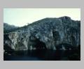
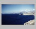 attic west coast and Mount Hymettos from south |
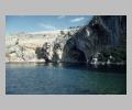
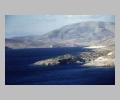 attic west coast from south |
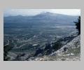
 view to Dema Pass between Aigaleos (left) and Parnes (right) |
 classical fortification wall of various masonry work |
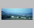
 overall view |
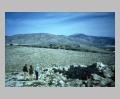
 view from south |
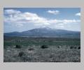
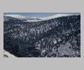 snow-capped peaks of Mount Parnes from south |
 Mount Pentelikon from Mount Parnes to northwest |
 Mount Pentelikon from northwest |
 Mount Pentelikon with snow cap, from southwest |
 Mount Pentelikon from south |