Railway, the Intercontinental
Or three Americas.—One of the important results of the international American conference, held in
Washington in 1889-90, was its recommendation that an international commission be created to ascertain the feasibility, the cost, and the available location for a railroad connecting the countries of
South and
Central America with
Mexico and the
United States.
This recommendation was cordially endorsed by
Secretary Blaine in submitting the report to
President Harrison, who transmitted it to Congress, asking that an appropriation be made to commence the surveys.
In the same act which authorized the establishment of the bureau of the
American republics—the diplomatic and consular appropriation act of July 14, 1890—the Intercontinental Railway Commission was created.
In this act it was provided that three commissioners on the part of the
 |
|
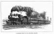
A Railroad train of the twentieth century. |
[
368]
United States should be appointed by the
President, with the advice and consent of the Senate, who were to act with representatives of the other American republics to devise plans for carrying out the objects recommended by the international American conference.
The commission organized Dec. 4, 1890, and at once set about equipping surveying parties to make a topographical examination.
The
United States representatives on the commission were practical railroad men—
A. J. Cassatt,
Henry G. Davis, and
R. C. Kerens, and eleven other republics were represented on the commission.
The report issued in March, 1899 (4 volumes), is accompanied with four sets of maps and profiles, exhibiting the surveys and examination of the country that were made from
Mexico through
Central America to
Colombia,
Ecuador, and
Peru, in
South America.
An estimate is given of the cost for grading, masonry, and bridges of that portion of the line, which must be constructed to complete the connections, which amount to $174,290,271.84.
As surveyed (1899), from New York City to
Buenos Ayres, the railway would be 10,221 miles long, and to finish and equip it would cost at least $200,000,000. This length and cost would also be increased when the line is extended through
Patagonia to the southern limits of
South America.
Complete surveys prove that a practical route can be had, and the road built in a reasonable time.
The route of this road can be traced on a railroad map, while the following table shows the distances, the miles built, and the gaps to be filled:
| Countries. | Built. | Proposed. | Total. |
| United States | 2,094 | | 2,094 |
| Mexico | 1,183 | 461 | 1,644 |
| ——— | ——— | ——— |
| Total in North America | 3,277 | 461 | 3,738 |
| Guatemala | 43 | 126 | 169 |
| San Salvador | 64 | 166 | 230 |
| Honduras | | 71 | 71 |
| Nicaragua | 103 | 106 | 209 |
| Costa Rica | | 360 | 360 |
| ——— | ——— | ——— |
| Total in Central America | 210 | 829 | 1,039 |
| Colombia | | 1,354 | 1,354 |
| Ecuador | | 658 | 658 |
| Peru | 151 | 1,633 | 1,784 |
| Bolivia | 195 | 392 | 587 |
| Argentina | 936 | 125 | 1,061 |
| ——— | ——— | ——— |
| Total in South America | 1,282 | 4,769 | 5,444 |
| ——— | ——— | ——— |
| Grand total | 4,769 | 5,452 | 10,221 |


