[
510]
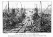
This cut and the one on the next page form one picture relating to the first day's battle.
Hurlbut,
McClernand, and
Sherman in the order mentioned, toward the right.
The modification of this position of the troops by the
Sherman edition, may be described as follows [see map, page 470]: Looking west over the map, we see a line on the east bank of the river marked “
Buell.”
No part of my army is represented on the west bank.
On the west side of the river, 400 yards back from the landing and parallel with the river, is a line 100 yards long marked “
Grant.”
Extending back from the river along
Dill's Branch, is a line half a mile long marked “Detachments.”
This might mean the reserve artillery.
From the outer extremity of the “Detachments” is a line two-thirds of a mile long running west, but swelling in the center well to the south, with its right resting on Tillman's Creek, and marked “
Hurlbut.”
On the right of
Hurlbut extending in the same west course, and entirely on the west side of Tillman's Creek, is a double line one-eighth of a mile long marked “
McClernand.”
Then commencing one hundred yards north-west of
McClernand's right and extending due north, along the edge of the field in front of the
camp of McClernand's First Brigade, is a line two-thirds of a mile long marked “
Sherman.”
On the right of this line are three houses covered in front by a sort of demi-lune and wing, between which and the main Sherman line is a bastion-like arrangement.
The demi-lune figure
Sherman designates as a “strong flank,” and says it was occupied by
Birge's sharp-shooters.
Off to the right is seen
Lew Wallace's division crossing Snake Creek bridge, and marching toward the demi-lune by a road which had no existence in fact or on the original
Thorn map. At the angle between
Sherman and
McClernand is a